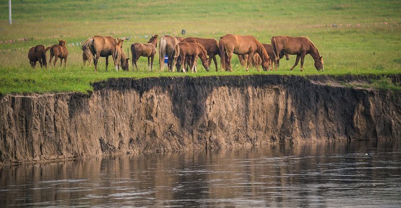
A recent terrestrial wildlife resource survey in Hulunbuir, Inner Mongolia, has identified 457 species of land animals. According to the Hulunbuir Municipal People’s Government News Office, the investigation covered 14 banners and districts, marking the largest and most systematic wildlife census in the region’s history.
The preliminary results, released on June 11, provide a comprehensive snapshot of the biodiversity currently residing within the Hulunbuir prefecture. This large-scale data collection effort was designed to map the distribution and population health of various terrestrial species across the region’s diverse ecological zones.
What was the scope of the Hulunbuir wildlife investigation?
The survey was an expansive undertaking that spanned all 14 banners and districts within the Hulunbuir municipality. By covering the entire administrative area, researchers were able to capture data from a wide range of habitats, including the vast Hulunbuir Grasslands, the forested regions of the Greater Khingan Range, and various wetland ecosystems.

The Hulunbuir Municipal People’s Government News Office characterized the mobilization as the most significant and systematic effort of its kind ever conducted in the area. Unlike previous smaller-scale observations, this investigation utilized standardized methodologies to ensure that the data collected across the 14 administrative divisions could be accurately compared and integrated into a single regional database.
The identification of 457 species suggests a highly complex ecosystem. While the specific breakdown of these species—ranging from large mammals to smaller reptiles and amphibians—has not been fully detailed in the initial announcement, the sheer number indicates a high level of biological richness. This data is expected to serve as a baseline for future monitoring of species’ population trends and habitat usage.
Why is this survey significant for Inner Mongolia?
Hulunbuir serves as a critical ecological buffer and a major biodiversity hotspot in northern China. The region sits at the intersection of several major biomes, which explains the high species count identified in the survey. The presence of both dense forestland and expansive steppe environments creates unique niches that support a varied array of fauna.

The findings are significant for several reasons:
- Ecological Baseline: The survey establishes a definitive scientific baseline that allows conservationists to measure the impact of climate change and human activity on local wildlife over time.
- Resource Management: For local authorities, understanding which species are present and where they congregate is essential for managing land use, particularly in areas where agriculture, grazing, and forestry overlap with wildlife habitats.
- Conservation Policy: The data provides the empirical evidence needed to designate new protected areas or to expand the boundaries of existing nature reserves within the 14 banners and districts.
The systematic nature of this survey reduces the “data gaps” that often plague regional wildlife management. By ensuring that remote banners were included in the count, the municipal government has improved the accuracy of the region’s overall ecological profile.
How will these findings impact local conservation?
The transition from data collection to active conservation management is the next critical phase for Hulunbuir. With 457 species now officially documented, local environmental agencies can prioritize species that may be vulnerable or rare within the region. This targeted approach allows for more efficient allocation of limited conservation funding and personnel.

One of the primary applications of this data will be in the development of “ecological corridors.” As human infrastructure expands, wildlife populations can become isolated. By knowing the exact distribution of species across the 14 districts, planners can design corridors that allow animals to move safely between fragmented habitats, such as moving from the Greater Khingan forests to the grassland edges.
Furthermore, the survey results will likely influence local regulations regarding grazing patterns and forest management. If certain species are found to be concentrated in specific districts, those areas may see stricter controls on land use to prevent habitat degradation.
Key Takeaways from the Hulunbuir Wildlife Survey
- Species Count: 457 terrestrial wildlife species were identified.
- Geographic Reach: The survey covered all 14 banners and districts in Hulunbuir.
- Historical Context: This is the largest and most systematic wildlife census in the region’s history.
- Official Source: Data was released by the Hulunbuir Municipal People’s Government News Office on June 11.
As the municipal government moves from the preliminary results phase toward a full report, the scientific community will be looking for more granular data regarding the population density of flagship species and the specific health of the habitats they inhabit.

The next scheduled update from the Hulunbuir Municipal People’s Government is expected once the full, detailed report of the investigation is finalized and vetted by regional environmental authorities.
What do you think about the importance of large-scale wildlife surveys in changing climates? Share your thoughts in the comments below and share this article with your network.
Worth a look