For decades, the Yellowstone supervolcano has existed in the public imagination as a ticking time bomb, a subterranean giant capable of altering the course of human civilization. Even as the prospect of a catastrophic eruption often borders on the cinematic, recent scientific findings are providing a far more complex—and nuanced—picture of what is actually happening beneath the surface of the American West.
New research into Yellowstone supervolcano activity suggests that the plumbing system of this volcanic behemoth is not what scientists once believed. Rather than a single, massive reservoir of liquid magma, evidence now points to a more volatile and dynamic structure that could change the timeline of how the volcano “recharges.” While experts maintain there is no immediate threat of an eruption, the discovery of a “magma mush zone” and unusual surface activity has reignited global discussions about the risks associated with supervolcanoes.
The shift in understanding comes as researchers move away from the classic model of a deep, concentrated magma chamber. Instead, new data indicates that the source of the volcano’s power is a dense, semi-molten layer of rock—a porridge-like consistency known as a magma mush zone—that sits significantly closer to the Earth’s crust than previously estimated. This structural difference is critical; it suggests that the process of the volcano filling with magma could occur more rapidly and more directly than older models predicted according to recent studies.
The ‘Magma Mush’ and the Mechanics of a Supervolcano
To understand why the “magma mush” theory is significant, one must first understand the scale of the Yellowstone Caldera. The supervolcano sits beneath a massive crater measuring approximately 48 x 64 kilometers. Unlike standard volcanoes, supervolcanoes are defined by their ability to produce eruptions of staggering proportions, ejecting more than 1,000 cubic kilometers of ash, lava, and rock into the atmosphere per event.
The traditional view held that these events were fueled by massive columns of magma rising from deep within the Earth. However, the identification of the magma mush zone suggests a layer of partially melted rock that is more integrated with the upper crust. This means the transition from a dormant state to an active one could potentially bypass some of the slower, deeper movements of magma, making the “filling” process more efficient. Despite this, geologists emphasize that the presence of this zone does not equate to an imminent eruption; rather, it provides a more accurate map of the volcano’s internal architecture.
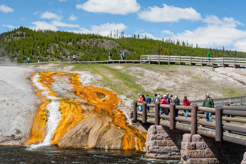
Surface Anomalies: The Norris Geyser Basin
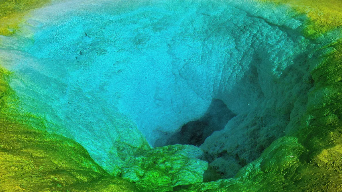
While the deep-earth structure is a matter of long-term study, surface activity provides the most immediate data for monitors. In the Norris Geyser Basin—one of the most dynamic, oldest, and hottest thermal areas in the park—scientists have identified a concerning new feature: a gap roughly 4 meters wide discovered by the U.S. Geological Survey (USGS).
This opening, which began forming around Christmas 2024 and was fully documented by April 10, 2025, is described as a “blue-water spring.” It’s a natural exit point producing exceptionally clear, transparent water. While it may appear serene, such hydrothermal features are often channels for fluctuating volcanic activity. This discovery followed another event just four months prior, when the USGS identified a newly opened volcanic vent that was actively emitting steam into the air in the same region.
Mapping the Deep: Magma Migration and Magnetotellurics
Beyond the surface vents, the movement of magma at extreme depths is being tracked with increasing precision. A research team led by seismologist Ninfa Bennington of the U.S. Geological Survey has utilized magnetotelluric measurements to analyze the magma reservoirs beneath the Yellowstone plateau. This method, which measures changes in the Earth’s magnetic and electric fields, is highly sensitive to the presence of subsurface melts as detailed in recent geophysical reports.
The findings are revealing. Bennington’s team identified seven distinct areas of high magma concentration located at depths ranging from 4 to 47 kilometers, extending all the way to the boundary between the crust and the mantle. Most notably, the data suggests that the magma chamber is gradually shifting toward the northeast. In this northeastern sector, researchers found significant masses of basaltic magma within the lower crust according to the USGS study.
This migration of magma raises new questions for volcanologists regarding the potential locations and timing of future activity. While the movement of magma is a natural part of a volcanic system’s lifecycle, the specific shift toward the northeast provides a new focal point for monitoring efforts.
The Global Stakes: What a Super-Eruption Would Imply
The anxiety surrounding Yellowstone stems from the sheer scale of its potential impact. History shows that the system is capable of extreme violence; records indicate between two and three massive caldera-forming eruptions over the last 2 to 2.1 million years and USGS data].
In the event of a full-scale super-eruption, the consequences would extend far beyond the borders of Wyoming. Experts warn that ash could cover up to two-thirds of the United States, rendering entire states uninhabitable as reported by monitoring agencies. The resulting environmental collapse would include:
- Atmospheric Toxicity: Toxic air currents sweeping across the continent, causing widespread respiratory crises.
- Infrastructure Collapse: The grounding of thousands of flights due to ash clouds, which are lethal to jet engines.
- Mass Displacement: Millions of people forced to abandon their homes as ash layers bury cities, and farmland.
- Global Climate Shift: The injection of massive quantities of sulfur and ash into the stratosphere, potentially triggering a “volcanic winter” that would disrupt global agriculture.
Key Geological Findings at a Glance
| Feature/Finding | Detail | Implication |
|---|---|---|
| Magma Mush Zone | Semi-molten rock layer closer to the surface | Potential for faster volcanic “recharging” |
| Norris Geyser Basin Gap | 4-meter wide “blue-water spring” | Channel for fluctuating volcanic activity |
| Magma Migration | Shift toward the northeast | Changes potential eruption sites/timing |
| Depth of Magma | 7 concentrations between 4km and 47km | Activity spans from crust to mantle boundary |
Understanding the Risk: Perspective vs. Panic
It is easy to interpret these findings as a countdown to disaster, but the scientific community urges a more measured perspective. The discovery of a new vent or a shift in magma location is a common occurrence in one of the world’s most active volcanic systems. The U.S. Geological Survey continues to monitor the park using a sophisticated network of sensors, ensuring that any genuine precursor to an eruption—such as massive, sustained ground uplift or intense earthquake swarms—would be detected long before a catastrophic event occurred.
The “magma mush” discovery is less a warning of an immediate blast and more a correction of our geological maps. By understanding that the volcano is fueled by a porridge-like layer of rock rather than a liquid lake of fire, scientists can better predict how the system responds to pressure and heat. For now, the most immediate “danger” in Yellowstone remains the hydrothermal explosions and boiling springs that claim the lives of unwary tourists who stray from designated boardwalks.
The scientific community will continue to analyze the magnetotelluric data and monitor the Norris Geyser Basin for further changes. The next phase of research will likely focus on the precise viscosity of the magma mush zone to determine exactly how much faster a potential recharge could occur compared to previous estimates.
World Today Journal will continue to monitor USGS updates regarding Yellowstone’s seismic and hydrothermal activity. We invite our readers to share their thoughts on the balance between scientific discovery and public alarm in the comments below.
Worth a look